TL;DR
In the United Kingdom, where you live often dictates far more than just your local shop or nearest park. It can profoundly influence your health, your wealth, and, critically, your access to and the cost of essential financial protection like life insurance, critical illness cover, and income protection. For many, the idea that a postcode could dramatically alter their insurance premiums might seem unfair or even arbitrary.
Key takeaways
- Health Disparities: Certain postcodes are statistically linked to poorer health outcomes, shorter life expectancies, and higher incidences of chronic diseases.
- Socioeconomic Factors: Areas with higher deprivation, lower income levels, or higher unemployment rates can indicate elevated health risks, lifestyle challenges, and potentially higher claims frequency or duration for income protection.
- Environmental Hazards: Proximity to sources of pollution, industrial areas, or even higher risks of natural disasters (like flooding) can impact health and, therefore, premiums.
- Crime Rates: While less direct for life and critical illness, areas with higher crime rates can sometimes be indicative of broader socioeconomic challenges that correlate with poorer health or mental wellbeing.
- Access to Healthcare: Though less directly modelled, areas with poorer access to timely healthcare can lead to delayed diagnoses or poorer management of conditions, potentially increasing the severity or duration of illness.
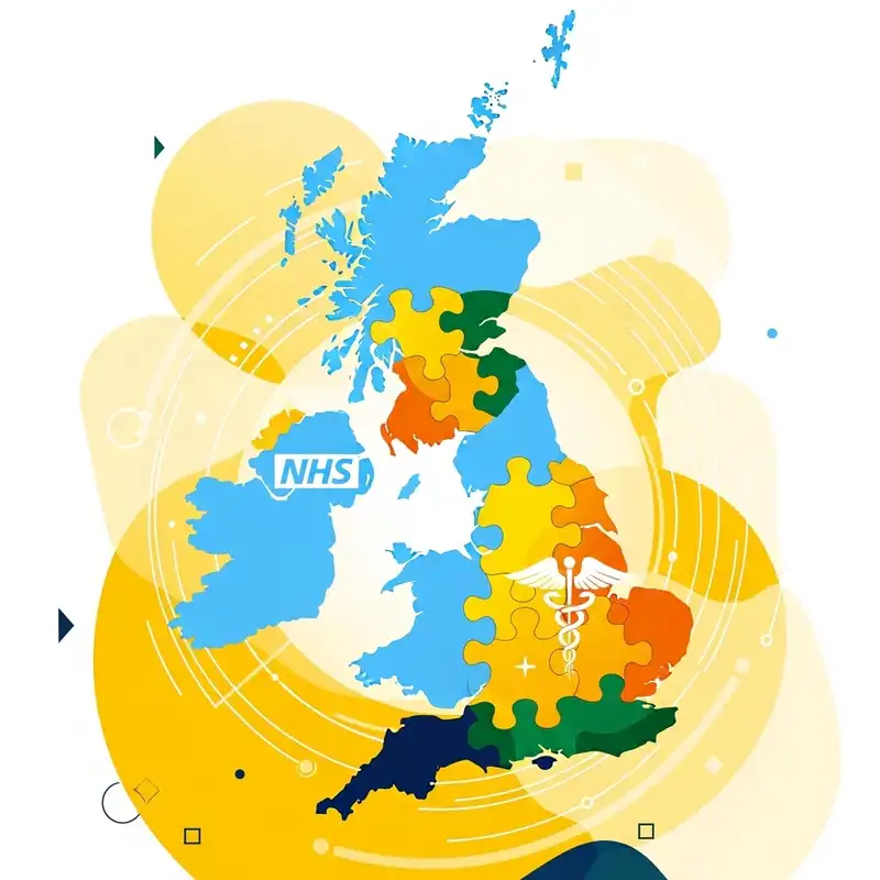
The UK's Great Protection Divide: How Your Postcode Impacts Life, Critical Illness & Income Protection Cover & Costs
The Great UK Protection Divide: How Postcode Impacts Life, Critical Illness & Income Protection Cover & Costs
In the United Kingdom, where you live often dictates far more than just your local shop or nearest park. It can profoundly influence your health, your wealth, and, critically, your access to and the cost of essential financial protection like life insurance, critical illness cover, and income protection. This is "The Great UK Protection Divide," a complex interplay of geography, health disparities, socioeconomic factors, and insurer risk assessment that creates significant variations in how affordable and accessible vital safety nets are across the nation.
For many, the idea that a postcode could dramatically alter their insurance premiums might seem unfair or even arbitrary. Yet, for insurers, your address is a powerful indicator, a proxy for a multitude of risks that directly impact their likelihood of paying out a claim. This article delves deep into this phenomenon, exploring how your postcode acts as a hidden determinant in the world of personal protection insurance, and what you can do to navigate this often-unequal landscape.
Understanding the Pillars of Protection: Life, Critical Illness & Income Protection
Before we unpack the postcode’s influence, let's briefly define the three core types of personal protection insurance at the heart of this discussion. These policies are designed to provide financial security when life takes an unexpected turn, protecting you and your loved ones from the financial fallout of illness, injury, or death.
- Life Insurance: This pays out a lump sum or regular payments to your beneficiaries if you pass away during the policy term. It's designed to cover funeral costs, clear debts (like a mortgage), or provide ongoing financial support for your family.
- Critical Illness Cover: This pays out a tax-free lump sum if you're diagnosed with a specified serious illness (e.g., cancer, heart attack, stroke) listed in the policy terms. It can help cover medical costs, adapt your home, or replace lost income during recovery, allowing you to focus on getting better without financial stress.
- Income Protection Insurance: This pays out a regular, tax-free income if you're unable to work due to illness or injury. It typically covers a percentage of your usual earnings (e.g., 50-70%) until you recover, return to work, or reach retirement age, providing a crucial safety net for your monthly outgoings.
Each of these policies is an indispensable component of a robust financial plan, yet their pricing and even availability can vary significantly depending on where you reside.
How Your Postcode Becomes a Risk Factor: The Insurer's Lens
Insurers are in the business of risk assessment. They gather vast amounts of data to predict the likelihood of a claim. While individual factors like age, medical history, occupation, and lifestyle (smoking, alcohol consumption) are primary considerations, your postcode provides a statistical snapshot of your environment. It aggregates risks that might be harder to quantify at an individual level but become clear when looking at population trends.
Here’s how a postcode can influence insurance premiums and availability:
- Health Disparities: Certain postcodes are statistically linked to poorer health outcomes, shorter life expectancies, and higher incidences of chronic diseases.
- Socioeconomic Factors: Areas with higher deprivation, lower income levels, or higher unemployment rates can indicate elevated health risks, lifestyle challenges, and potentially higher claims frequency or duration for income protection.
- Environmental Hazards: Proximity to sources of pollution, industrial areas, or even higher risks of natural disasters (like flooding) can impact health and, therefore, premiums.
- Crime Rates: While less direct for life and critical illness, areas with higher crime rates can sometimes be indicative of broader socioeconomic challenges that correlate with poorer health or mental wellbeing.
- Access to Healthcare: Though less directly modelled, areas with poorer access to timely healthcare can lead to delayed diagnoses or poorer management of conditions, potentially increasing the severity or duration of illness.
Insurers don't penalise you personally for living in a certain area, but they apply statistical models based on the collective data associated with that postcode. If the data suggests a higher aggregated risk of illness, injury, or premature death in your area, your premiums will likely reflect that.
The Stark Reality: Health Disparities by Postcode
The most significant way your postcode impacts protection insurance is through its strong correlation with health inequalities. The UK's health landscape is far from uniform, with alarming differences in life expectancy and disease prevalence across different regions and even within the same city.
Life Expectancy: A Tale of Two Postcodes
The Office for National Statistics (ONS) consistently highlights a striking "North-South divide" and urban-rural variations in life expectancy. For example:
- Deprived vs. Affluent Areas: As of recent ONS data, the gap in life expectancy between the most and least deprived areas in England can be as much as 10 years for men and 8 years for women. A man living in a highly deprived area might expect to live to 74.3 years, compared to 84.1 years in the least deprived areas.
- Regional Differences: Life expectancy is generally higher in the South East of England and lower in parts of the North East, North West, and certain Scottish regions. For instance, a baby boy born in Kensington and Chelsea might expect to live over 84 years, while one born in Blackpool could expect to live just under 75 years. This nearly decade-long difference is a stark reality that insurers cannot ignore.
Chronic Disease Prevalence: A postcode Lottery for Health
It's not just about how long you live, but how healthy you are during those years. Postcodes are often correlated with the prevalence of chronic diseases:
- Heart Disease and Stroke: Areas with higher rates of poverty, unemployment, and less access to healthy food options often see higher rates of cardiovascular disease. The British Heart Foundation has shown that deaths from heart and circulatory diseases are significantly higher in the most deprived areas.
- Cancer: While cancer can affect anyone, certain types are more prevalent in areas with higher levels of environmental pollution or specific lifestyle risk factors (e.g., smoking rates, which are higher in some deprived areas). Cancer Research UK data shows a clear link between deprivation and cancer incidence and mortality.
- Obesity and Type 2 Diabetes: Postcodes in areas lacking green spaces, safe walking routes, and affordable healthy food (often termed "food deserts") tend to have higher rates of obesity, which in turn fuels Type 2 diabetes. NHS data indicates a disproportionate burden of these conditions in deprived communities.
- Respiratory Illnesses: Proximity to busy roads, industrial sites, or areas with poorer air quality can lead to higher rates of asthma, COPD, and other respiratory conditions. For example, Public Health England data has highlighted areas in major cities with significantly higher levels of air pollution.
Mental Health: The Unseen Divide
Mental health is another critical factor. While not always directly reflected in physical illness statistics, areas with higher unemployment, social isolation, and financial stress often report higher rates of anxiety, depression, and other mental health conditions. These can impact income protection claims, as mental health issues are a leading cause of long-term absence from work.
Table 1: Indicative Health Disparities by UK Postcode Type
| Health Indicator | Affluent Urban/Suburban Postcode (e.g., SW1, HP9) | Deprived Urban/Industrial Postcode (e.g., L3, BD3) | Rural/Remote Postcode (e.g., PH41, SA72) | Insurer Impact |
|---|---|---|---|---|
| Life Expectancy (Men) | 82-84 years | 74-76 years | 77-80 years | Higher premiums for life/critical illness in lower LE areas. |
| Chronic Disease Rates | Lower (e.g., obesity, CVD, diabetes) | Higher | Variable (depends on specific area) | Increased critical illness risk, potential higher income protection claims. |
| Air Pollution Exposure | Lower | Higher | Lower (but can be local issues) | Higher respiratory illness risk. |
| Access to Green Space | High | Lower | High | Indirect impact on physical and mental health. |
| Smoking Rates | Lower | Higher | Variable | Direct impact on life/critical illness premiums. |
| Mental Health Issues | Lower/Moderate | Higher | Variable (social isolation in rural areas) | Higher income protection claim risk. |
The aggregate picture for insurers is clear: certain postcodes present a statistically higher risk profile in terms of health, leading to adjustments in premiums for life, critical illness, and income protection.
Socioeconomic Factors: Beyond Health
Beyond direct health outcomes, the socioeconomic fabric of a postcode area plays a significant role in risk assessment for insurers.
Income Levels and Affordability
Areas with lower average household incomes may face challenges in affording insurance premiums. This creates a vicious cycle: those who might need protection most (due to higher aggregated health risks) are often least able to afford it. Insurers might see lower uptake in these areas, and for income protection, the stability of income itself is a factor.
Employment Stability and Occupation
For income protection specifically, the prevalence of certain occupations within a postcode can be a factor. Areas heavily reliant on manual labour or industries with higher rates of injury might see higher income protection premiums. Furthermore, areas with higher unemployment rates can indirectly signal a more volatile economic environment, which could impact claims for income protection, even if an individual is employed.
Deprivation Indices
The UK government publishes various deprivation indices (e.g., Index of Multiple Deprivation in England, Scottish Index of Multiple Deprivation). These complex metrics combine factors like income, employment, health, education, housing, crime, and living environment. Insurers use these indices, or similar proprietary data sets, to gain a holistic understanding of the risks associated with a particular area. A high score on these indices means higher deprivation, which statistically correlates with poorer health outcomes and greater financial vulnerability.
Table 2: Key Socioeconomic Indicators and Insurance Impact
| Socioeconomic Indicator | Low Deprivation Postcode (e.g., Guildford) | High Deprivation Postcode (e.g., parts of Glasgow) | Insurance Impact (General) |
|---|---|---|---|
| Average Income | Higher | Lower | Affordability of premiums, sum assured chosen. |
| Employment Rate | Higher | Lower | Impact on income protection claims (stability), general health. |
| Education Levels | Higher | Lower | Correlates with health literacy and lifestyle choices. |
| Access to Resources | Better (shops, services, green spaces) | Poorer | Indirect impact on health behaviours and outcomes. |
| Crime Rate | Lower | Higher | Can indicate broader social challenges, indirect health correlation. |
Environmental Factors: The Air You Breathe, The Water You Drink
While often overlooked, the immediate environment linked to a postcode can also contribute to the protection divide.
Air Quality
Living near major roads, industrial zones, or in urban centres with high traffic congestion exposes residents to higher levels of air pollution (e.g., PM2.5, nitrogen dioxide). Long-term exposure to these pollutants is linked to increased risks of:
- Respiratory diseases (asthma, COPD).
- Cardiovascular diseases (heart attacks, strokes).
- Certain cancers (e.g., lung cancer).
Insurers use postcode data to assess these environmental risks, which can directly translate into higher premiums for critical illness cover and life insurance, particularly for respiratory and cardiovascular conditions.
Proximity to Industrial Hazards
Postcodes near heavy industry, chemical plants, or historical industrial sites might face elevated risks from specific contaminants in the air, soil, or water, potentially increasing cancer risks or other health conditions.
Flooding Risk
While primarily impacting home insurance, areas prone to flooding can have indirect effects. Flood events can cause significant stress, displacement, and mental health issues, potentially leading to income protection claims or impacting overall wellbeing. Some critical illness policies may also have clauses related to environmental exposures.
Table 3: Environmental Factors and Insurance Relevance
| Environmental Factor | Postcode Type with Higher Exposure | Relevant Insurance Product | Potential Impact on Premiums/Claims |
|---|---|---|---|
| Air Pollution | Urban centres, industrial zones | Life, Critical Illness | Higher risk of respiratory/CVD conditions; increased premiums. |
| Industrial Hazards | Near heavy industry | Life, Critical Illness | Elevated cancer/other disease risks; increased premiums. |
| Noise Pollution | Busy roads, airports | Income Protection (mental health) | Indirectly impacts stress, sleep, mental wellbeing. |
| Flooding Risk | Flood plains | Income Protection (indirect) | Mental health impact from events; property damage stress. |
The Underinsurance Problem: A Vicious Cycle
The cumulative effect of these postcode-driven disparities is often an exacerbation of the underinsurance problem in the UK. Data from organisations like the Association of British Insurers (ABI) consistently show that a significant portion of the population lacks adequate financial protection. This problem is particularly acute in areas that are already disadvantaged.
Why do areas with higher statistical health risks often have lower levels of protection?
- Affordability: Higher premiums due to postcode factors combine with lower average incomes, making cover simply unaffordable for many.
- Awareness and Education: There may be less access to financial advice or less public awareness campaigns about the importance of protection insurance in deprived areas.
- Trust and Prioritisation: For those struggling with daily living costs, insurance might be perceived as a luxury or a complex product they don't fully understand or trust. Other immediate financial pressures take precedence.
- Accessibility: Fewer local independent financial advisors or brokers might operate in certain areas, limiting face-to-face access to advice.
This creates a tragic paradox: the very communities that could benefit most from a financial safety net are often the least likely to have it. When illness, injury, or death strikes, the financial consequences are far more devastating for families already on the economic margins.
The Insurer's Perspective: Data, Actuarial Science & Ethics
From an insurer's standpoint, using postcode data is not about discrimination, but about accurate risk pricing. They operate on the principle of risk pooling – collecting premiums from a large group to pay out claims for the few. To ensure the pool remains solvent and premiums are fair for the majority, they must accurately assess individual risk contributions.
How Insurers Use Data
Insurers utilise sophisticated actuarial models that combine various data points:
- Publicly Available Data: ONS statistics, Public Health England/Wales/Scotland data, environmental agency data, crime statistics.
- Proprietary Data: Their own historical claims data, customer demographics, and insights from medical databases (anonymised).
- Third-Party Data: Specialist data providers who analyse vast datasets to identify correlations between geography and risk factors.
This data is then fed into algorithms that help underwriters determine the specific premium for an applicant, factoring in all known risks, including those associated with their postcode.
Actuarial Fairness vs. Social Fairness
This approach highlights the tension between actuarial fairness and social fairness.
- Actuarial Fairness: This dictates that premiums should accurately reflect the risk posed by an individual or group. If a postcode statistically implies higher risk, a higher premium is actuarially fair.
- Social Fairness: This suggests that everyone, regardless of their circumstances, should have access to essential services and protections at an affordable price, even if it means cross-subsidisation.
In a commercial insurance market, the emphasis is typically on actuarial fairness. Insurers argue that if they didn't accurately price risk, those in lower-risk categories would end up subsidising higher-risk categories, leading to an unfair system for them, and potentially making the insurance product unsustainable in the long run.
The Financial Conduct Authority (FCA) regulates the insurance market to ensure fair treatment of customers, but insurers are generally permitted to price risk based on valid statistical differences.
Navigating the Divide: Tips for Consumers
While the postcode divide is a systemic issue, there are proactive steps individuals can take to secure the best possible protection for their circumstances.
- Be Honest and Thorough: Always provide accurate information on your application. Non-disclosure can lead to claims being rejected. While your postcode is a fixed fact, your personal health and lifestyle habits are also crucial.
- Focus on Lifestyle Improvements: While you can't change your postcode, you can control many personal risk factors. Quitting smoking, maintaining a healthy weight, managing chronic conditions effectively, and reducing alcohol intake can significantly improve your personal risk profile and potentially lead to lower premiums.
- Understand What You Need: Don't just pick a random sum assured. Work out your financial obligations (mortgage, debts, family living costs) to determine an appropriate level of cover for life insurance. For income protection, calculate your essential monthly outgoings.
- Shop Around Extensively: This is perhaps the most crucial tip. Different insurers use different underwriting models and data sets. One insurer might rate a postcode more harshly than another, or have a greater appetite for certain types of risk.
- Direct vs. Broker: While you can get quotes directly from insurers, using an independent insurance broker is often the most effective strategy. They have access to policies from a wide range of providers and can compare not just prices but also terms and conditions.
- Leverage Expert Advice: An expert insurance broker understands the nuances of the market. They can help you:
- Identify the best insurer for your specific postcode and health profile.
- Structure a policy that meets your needs and budget.
- Navigate the application process, ensuring all details are correctly presented.
- Explain policy clauses and exclusions clearly.
At WeCovr, we specialise in helping individuals like you compare life, critical illness, and income protection plans from all major UK insurers. We understand that your circumstances are unique, and we leverage our expertise to find you the right coverage at the most competitive price, helping to bridge the protection divide.
The Future of Underwriting: Towards More Granular Data?
The use of postcode data in underwriting is a broad-brush approach. However, advancements in data analytics and technology are paving the way for more granular and potentially more personalised risk assessment.
- Wearable Technology: Fitness trackers and smartwatches collect vast amounts of health data (heart rate, activity levels, sleep patterns). Some innovative insurers are experimenting with offering premium discounts to policyholders who share this data and demonstrate healthy behaviours. This could shift the focus from a collective postcode risk to individual, real-time health management.
- Genetic Information (with strong ethical boundaries): While currently heavily regulated in the UK (insurers cannot request or use predictive genetic test results for most policies), future advancements might bring this into ethical discussions for certain conditions, leading to truly personalised pricing based on individual predisposition rather than postcode averages.
- Open Banking and AI: The ability to analyse spending habits (with consent) could provide insights into lifestyle, while AI could process complex medical records and lifestyle data more efficiently to create highly tailored risk profiles.
The ethical implications of such highly personalised underwriting are significant. While it could lead to fairer pricing for those who are currently penalised by broad postcode averages, it also raises concerns about privacy, data security, and the potential for certain individuals to become "uninsurable" if their data indicates exceptionally high risk. The debate between actuarial fairness and social inclusion will continue to evolve alongside technological progress.
Conclusion: Bridging the Protection Gap
The Great UK Protection Divide, where your postcode impacts the cost and accessibility of vital insurance, is a complex issue rooted in deep-seated health and socioeconomic inequalities. While insurers use postcode data as a legitimate tool for risk assessment, it creates a challenging landscape for many individuals who reside in areas deemed higher risk.
Understanding how your postcode affects your life, critical illness, and income protection premiums is the first step towards navigating this divide. By focusing on controllable lifestyle factors, meticulously shopping around, and, crucially, seeking expert advice from an independent insurance broker, you can significantly improve your chances of securing the comprehensive and affordable protection you and your family deserve.
Don't let your postcode be a barrier to financial security. With the right guidance and a proactive approach, it is possible to bridge the protection gap and ensure peace of mind, no matter where you call home in the UK. We at WeCovr are committed to helping you find the right protection solution, comparing options from leading providers to ensure you get the best cover tailored to your unique circumstances.
Sources
- Office for National Statistics (ONS): Mortality and population data.
- Association of British Insurers (ABI): Life and protection market publications.
- MoneyHelper (MaPS): Consumer guidance on life insurance.
- NHS: Health information and screening guidance.